Geography Icons: Elevating Visual Communication in Modern Projects
In the landscape of digital and print design, clarity and visual efficiency are paramount. Whether you’re mapping out a user journey for a mobile app, illustrating data for a corporate report, or designing marketing materials for a local business, the icons you choose carry significant weight. They are not mere decorations; they are functional signposts that guide understanding and enhance user experience. This is where a specialized asset like Geography Icons becomes a critical tool in a creator’s workflow.
The Role of Specialized Icon Sets in Project Planning
Before a single line of code is written or a layout is finalized, the planning phase involves assembling the right visual resources. A generic icon set might cover basics, but projects with a geographical, logistical, or location-based component demand precision. Geography Icons fits into this preparatory stage by providing a coherent visual language specifically for maps, travel, infrastructure, data visualization, and environmental themes. Integrating this set early ensures that from wireframes to final mockups, your designs maintain a consistent thematic thread, eliminating the later scramble to find suitable replacements.
For a marketing professional planning a campaign for a tourism app, having icons for landmarks, transportation modes, and regional features readily available accelerates the creation of storyboards and promotional flyers. An educator designing an online course on environmental science can immediately source icons for ecosystems, climate symbols, and global metrics, making the learning material more engaging and intuitively navigable.
Integration with Design Tools and Team Workflows
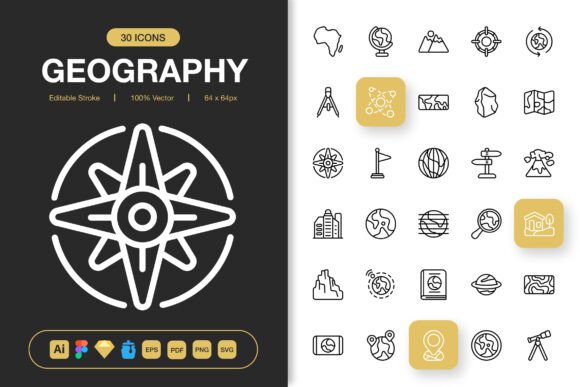
The true test of any digital asset is its seamless integration into existing tools and collaborative environments. The Geography Icons set is provided in multiple file formats—Adobe Illustrator, Figma, Sketch, EPS, SVG, and PNG—which speaks directly to a practical, process-oriented need. This compatibility allows it to slot into diverse workflows without conversion hurdles.
A designer in a team using Figma for UI design can drag and drop the Figma file directly into their library, making the icons instantly available for all project collaborators. A freelance graphic designer working on a print poster can open the Illustrator source file, customize the editable stroke of an icon to match the brand’s line weight, and export it without quality loss. This interoperability reduces friction between different stages of production, whether moving from digital prototyping to high-resolution print output.
Practical Implementation Across Project Types
The application of Geography Icons extends across the entire project lifecycle. Its high-quality, scalable PNGs (from 32px to 512px) make it suitable for implementation during the development phase for a mobile app, ensuring crisp rendering on various screen densities. Later, the same icon set can be used in the post-launch phase for creating social media banners, infographics for user analytics, or even printed merchandise.
Consider a small business owner developing a website for a logistics company. During the site build, the SVG icons can be used for interactive elements on a service map. After launch, the same icons, in high-resolution PNG format, can be repurposed for a printed brochure explaining service routes. This continuity of visual assets across mediums reinforces brand identity and message clarity.
Customization and Long-Term Asset Management
A key factor in long-term usability is customizability. The editable stroke feature of the Geography Icons source files means they are not static images but adaptable components. This allows for adjustments during a project’s refinement stage—perhaps to align with a newly chosen color palette or to simplify a detail for better clarity at smaller sizes. For a product manager overseeing a website redesign, this means the icon set can evolve with the brand, avoiding the need for a costly and time-consuming search for a new set mid-project.
Organization is another practical concern. Including files like an IconJar library helps designers systematically categorize and access the icons, turning a collection of 100 assets into a manageable, efficient resource. This structure supports quality control by ensuring every team member uses the correct, updated version of an icon, maintaining visual consistency across all outputs.
Enhancing Outcomes in Specific Use Cases
The impact of a well-chosen icon set is most visible in the outcomes it enables. For a blogger focusing on travel, using distinctive, high-quality geography icons within posts and downloadable city guides improves reader engagement and makes complex information like transit systems easily digestible. For a publisher creating an educational book, the icons provide reliable, royalty-free graphics that elevate the professional quality of the publication without licensing worries.
In the realm of data presentation, icons are indispensable. An analyst creating an infographic on global trade patterns can use standardized icons for ports, airplanes, and trucks to create an intuitive chart that communicates faster than text-heavy tables. The minimalist design of the icons ensures they don’t overwhelm the data, adhering to the principle that good design supports the message, not distracts from it.
Moving Beyond Single Projects
A valuable resource like Geography Icons changes how you approach not just one project, but your entire creative process. By establishing a trusted library of thematic icons, you reduce the repetitive task of asset sourcing for every new task. This efficiency allows more time to be spent on core creative decisions and execution. For a freelancer or agency managing multiple client projects with geographical elements, this set becomes a foundational asset that increases turnaround speed and delivers consistently professional results.
The final delivery, including a straightforward Readme.txt file, underscores a user-centric approach. It ensures that regardless of a user’s technical expertise, they can successfully integrate the icons into their work. This attention to the complete user experience—from acquisition to application—is what transforms a collection of graphics into a genuine workflow tool. By focusing on practical integration, robust file support, and design flexibility, Geography Icons serves as a catalyst for clearer communication and more polished projects across the vast geography of modern creative work.